
Itinerary for 8 Days Lemosho
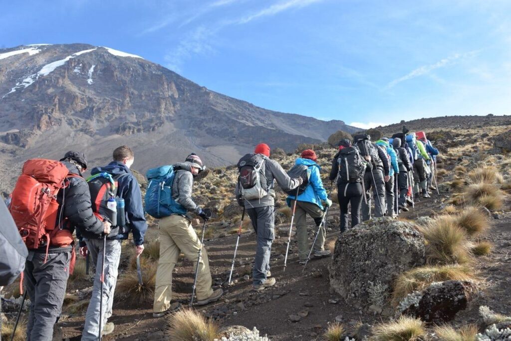
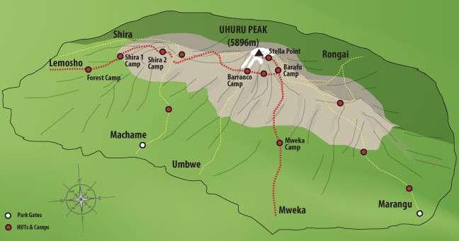
Day 1: Londorossi Gate → Mti Mkubwa Camp
- Elevation: 2,100 m → 2,750 m
- Distance / time: ~6 km, 3-4 hours
- Habitat: Montane rainforest
After the drive from Moshi to Londorossi Gate and the park paperwork, a rough track takes you to the Lemosho trailhead. You walk into quiet, remote rainforest on the western side of the mountain. This is one of the best stretches for wildlife, with colobus monkeys, birds and, rarely, buffalo or elephant. For that reason an armed ranger walks with the group on this day. Mti Mkubwa means “big tree” in Swahili.
Camp is set up when you arrive, with hot washing water and dinner in the mess tent.
Tips: Start slowly. Your pace on day one sets the tone for the whole climb.
Day 2: Mti Mkubwa Camp → Shira 1 Camp
- Elevation: 2,750 m → 3,500 m
- Distance / time: ~9 km, 5-6 hours
- Habitat: Forest to moorland
The forest thins into heather and open moorland as you climb onto the western Shira Plateau. Views of Kibo and Mt Meru open up, and you see the scale of the climb ahead for the first time. Shira 1 sits on wide, open ground, and the nights turn cold.
Tips: Drink at least 3 litres of water. Mild headaches can start as you pass 3,000 m.
Day 3: Shira 1 Camp → Shira 2 Camp
- Elevation: 3,500 m → 3,850 m
- Distance / time: ~7 km, 4-5 hours
- Habitat: Shira Plateau
A gentle, scenic day across the plateau, the floor of an ancient collapsed volcano. The gain in height is small, which gives your body time to adjust. Shira 2 has wide views toward the summit and some of the best sunsets of the trek.
Tips: Keep your layers handy, because the temperature drops quickly after sunset.
Day 4: Shira 2 Camp → Lava Tower → Barranco Camp
- Elevation: 3,850 m → 4,630 m (Lava Tower) → 3,950 m
- Distance / time: ~15 km, 6-8 hours
- Habitat: Alpine desert
This is the key acclimatization day: “climb high, sleep low.” You cross barren rock to Lava Tower, a 90 m volcanic plug, and stop for lunch at 4,630 m. The thin air may bring a headache or nausea, but the exposure helps your body prepare for summit night. You then descend past giant groundsels to Barranco Camp, tucked in a valley beneath the Barranco Wall. Sleeping lower is what makes this day work.
Tips: If you feel unwell at Lava Tower, tell your guide. Descending is the best remedy, and you’re heading down anyway.
Day 5: Barranco Camp → Barranco Wall → Karanga Camp
- Elevation: 3,950 m → 4,200 m (top of wall) → 3,995 m
- Distance / time: ~5 km, 4-5 hours
- Habitat: Alpine desert
The day starts with the Barranco Wall, a ~257 m rock face. It looks intimidating but it is a scramble, not a technical climb: you use your hands in places and follow a clear route. Beyond the top, ridges and valleys lead down to Karanga Camp. It’s a short day with time to rest.
Tips: Keep your daypack light and your poles secured on the wall.
Day 6: Karanga Camp → Barafu Camp
- Elevation: 3,995 m → 4,600 m
- Distance / time: ~4 km, 3-4 hours
- Habitat: Rocky alpine desert
A short, steady climb to Barafu (“ice” in Swahili), where the Lemosho route joins the Machame route. The camp is exposed and windy. Eat an early dinner, rest as much as you can, and listen to your guides’ briefing on layers, headlamps, water and snacks. Most groups wake around 11 pm-midnight.
Tips: Prepare your gear before sleeping. Keep water bottles from freezing, and eat and hydrate even if your appetite is low.
Day 7: Barafu Camp → Uhuru Peak → Mweka Camp
- Elevation: 4,600 m → 5,895 m → 3,100 m
- Distance / time: ~5 km up (6-8 hrs), ~12 km down (5-7 hrs)
- Habitat: Arctic summit zone → rainforest
You set off around midnight by headlamp, climbing steadily over scree in extreme cold, often -10 to -20 °C with wind chill. After several hours you reach Stella Point (~5,756 m) on the crater rim as the sky begins to lighten. Another 45-90 minutes along the rim takes you to Uhuru Peak, the highest point in Africa, ideally around sunrise. Photos are quick, because you can’t linger at this altitude.
Then comes a long descent to Barafu for a rest and snack, and on to Mweka Camp in the forest zone, where the air is thicker and warmer. Expect 12-15 hours on your feet in total.
Tips: Trekking poles help the descent enormously. Keep your phone and camera warm, because batteries die fast in the cold.
Day 8: Mweka Camp → Mweka Gate
- Elevation: 3,100 m → 1,640 m
- Distance / time: ~10 km, 3-4 hours
- Habitat: Rainforest
A gentle descent through lush forest, though the trail can be muddy and slippery. At Mweka Gate you sign out and collect your summit certificate (green for Stella Point, gold for Uhuru Peak). Your crew celebrates with songs, and you tip them. You then transfer to your hotel for a hot shower and a proper meal.