
Itinerary for 6 Days Rongai
Day 1: Rongai Gate → Simba Camp
- Elevation: 1,950 m → 2,650 m
- Distance / time: ~8 km, 3-4 hours
- Habitat: Farmland and pine forest
From Moshi it is a drive of about three hours to Rongai Gate. You start through farmland and quiet pine and rainforest on a gentle trail, and colobus monkeys are common. Simba Camp sits at the forest edge, and the first night is calm and easy.
Tips: Start slowly and keep a rain jacket handy, although this side of the mountain is drier.
Day 2: Simba Camp → Kikelewa Camp
- Elevation: 2,650 m → 3,600 m
- Distance / time: ~14 km, 6-7 hours
- Habitat: Moorland
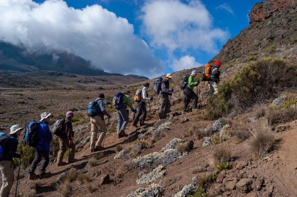
The forest opens into heather and moorland, with views north over the plains toward Kenya. It is a long, steady climb with few other groups on the trail. Kikelewa Camp sits in a sheltered valley near a cave, with the jagged peaks of Mawenzi ahead.
Tips: Drink at least 3 litres. Mild headaches can start as you pass 3,000 m.
Day 3: Kikelewa Camp → Mawenzi Tarn Camp
- Elevation: 3,600 m → 4,330 m
- Distance / time: ~4 km, 3-4 hours
- Habitat: Alpine desert
A short, steep day to Mawenzi Tarn, a high camp below the rock towers of Mawenzi. The afternoon is free for rest, and many groups take a short acclimatization hike higher and come back down. The landscape is stark and beautiful, and the camp is cold at night.
Tips: The easy afternoon is part of the plan. Rest and drink rather than wander far.
Day 4: Mawenzi Tarn Camp → Kibo Camp
- Elevation: 4,330 m → 4,700 m
- Distance / time: ~9 km, 5-6 hours
- Habitat: Alpine desert (the Saddle)
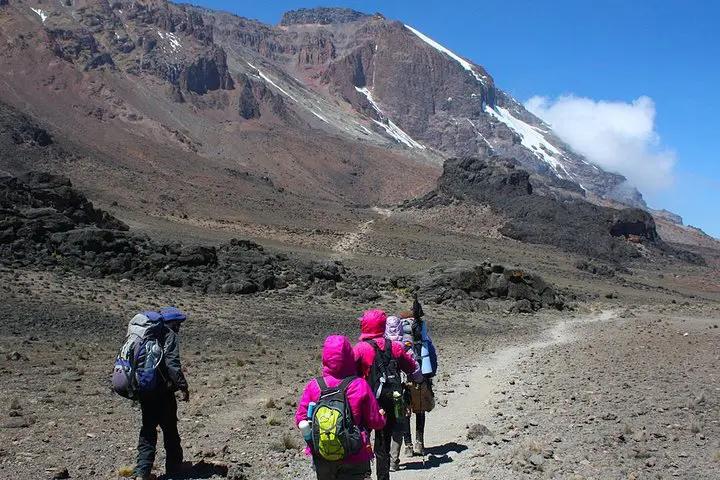
You cross the Saddle, a high, barren plain between Mawenzi and Kibo, with the summit slope in view the whole way. The air is thin and the wind strong. At Kibo you eat an early dinner and try to sleep for a few hours before the midnight start.
Tips: Prepare your layers, headlamp and water before lying down.
Day 5: Kibo Camp → Uhuru Peak → Horombo Hut
- Elevation: 4,700 m → 5,685 m (Gilman’s Point) → 5,895 m → 3,720 m
- Distance / time: ~21 km, 12-15 hours
- Habitat: Arctic summit zone → moorland
You start around midnight by headlamp and climb steep scree in extreme cold, often -10 to -20 °C with wind chill. After several hours you reach Gilman’s Point (5,685 m) on the crater rim as the sky lightens. Another 1-2 hours along the rim leads to Uhuru Peak, the highest point in Africa, ideally at sunrise. You then descend a long way to Horombo Hut for the night.
Tips: Trekking poles help the descent. Keep your phone and camera warm, because batteries die fast.
Day 6: Horombo Hut → Marangu Gate
- Elevation: 3,720 m → 1,860 m
- Distance / time: ~20 km, 5-7 hours
- Habitat: Moorland → rainforest
A long but gentle walk down through moorland and then forest, past Mandara Hut. At Marangu Gate you sign out and collect your summit certificate (green for Gilman’s Point, gold for Uhuru Peak). Your crew celebrates, and you tip them. You then transfer to your hotel for a hot shower and a proper meal.